 |
 |
 |
 |
 |
|
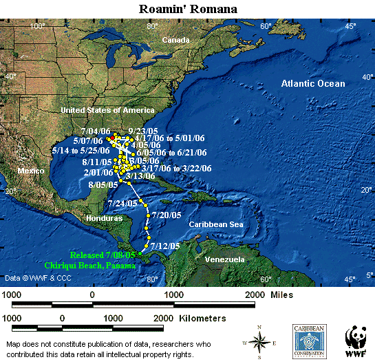
Cumulative distance traveled: 8,235 km (5,117 miles) |
Distance covered since last location: 35 km |
|
|
Maximum dive depth: 830 m (2,723 feet) |
Maximum dive depth since last location: 53 m |
|
|
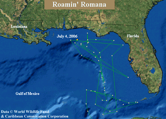
Notes: Roamin’ Romana has moved northeast and continues to stay just south of the coast of the border between Alabama and Florida. A recent dive lasted over 40 minutes. Straight line distance from release site is 2,320 km. |
Sea floor depth: between 200 m and 3,500 m |
|
Cumulative Distance refers to how far the turtle has actually travelled since it was first tagged. Straight Line Distance refers to the distance between where the turtle was first tagged and its current position in a straight line.Please note: The presentation of data here does not constitute publication, and the researchers who contributed this data retain all intellectual property rights. |
||
Map courtesy of Sea Turtle Conservancy. Data © WWF and Partners.
This map is updated with new points as soon as they are received by the Sea Turtle Conservancy. The red location point is the most recent location received for this turtle. If the red point is more than two months old, then the transmitter is most likely no longer working.
Map may be reproduced for educational or conservational purposes with the following credit: “Data © WWF and STC, map courtesy of STC.”