 |
 |
 |
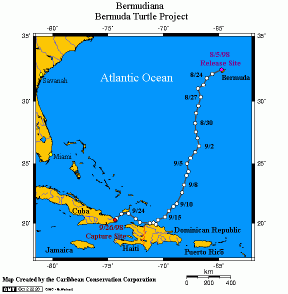
Comments: Bermudiana, a 31-inch immature green turtle, was captured with a net and satellite-tagged by the Bermuda Turtle Project on August 5, 1998 on the seagrass beds off the northwestern end of Bermuda. She was the second-largest green turtle that has been handled by the project since it began in 1968, and thus, it was expected that she would soon be departing the Bermuda platform. About two weeks later, she did, in fact, depart and embarked on a south/southwestward course that took her to the north coast of the Dominican Republic – a journey of approximately 1500 km – in a little less than a month! She then took a westward course along the northern coasts of the Dominican Republic and Haiti and was in this area when Hurricane Georges passed by. There were no observable effects of the hurricane. Several days later, however, satellite transmissions were disrupted, and when they resumed, sensors indicated that the turtle was no longer diving. At that time, the turtle was located right off the eastern tip of Cuba. Several location signals were then received slightly inland, near the town of Baracoa, and we suspect that the turtle was captured.