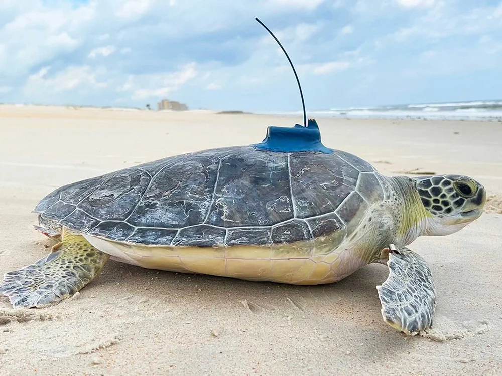
Tracking

Otis

Otis is a juvenile green sea turtle that was found stranded on Crescent Beach, Florida in February, 2024 as part of a stranding event on Florida’s east coast. Otis was taken to Sea Turtle Hospital at Whitney Lab for triage and was then later transferred to The Florida Aquarium for rehabilitation. After months of care, Otis was cleared for release and released with a satellite tag on September 18, 2024. Otis measured 50.5 cm CCL (shell length). Otis’ satellite transmitter was sponsored by Verizon.

Trans Alps Adventure

Migration Map

Hover over location circle to view date, and over the turtle icon to view most recent date.

Cumulative distance traveled: 654 km (407 miles)
Distance covered since last location: 3.93 km (2.44 miles)
Average speed since release: 0.19 kph (0.12 mph)
Average speed since last location: 0.16 kph (0.10 mph)
Time since last location update: 436 hours
Time tracked: 143 days

Sponsors & Partners:

On average, transmitters will send signals for around 1 year from the time the turtle is released. Sometimes it can be 2 years, and sometimes it can be less than a year. The turtle icon location point represents the most recent location received for this turtle. It is not uncommon for a transmitter to skip a day or two due to the turtle’s behavior or biofouling on the transmitter or antenna. This map is automatically updated with new points as soon as they are received by the Sea Turtle Conservancy. If the most recent point is more than two months old, then the transmitter is most likely no longer working.

The presentation of data here is for educational and entertainment purposes and does not constitute publication, and the researchers who contributed this data retain all intellectual property rights. Map, materials, images or data may NOT be used without permission. Use of this map, material, images, or data for any purpose (including, but not limited to, reproduction and distribution) without the written consent of the Sea Turtle Conservancy or the researcher/institute contributing the data is prohibited.

Map created by Mapotic for Sea Turtle Conservancy. Data and Map © STC (unless otherwise noted)

**SCAM ALERT!** If you have been offered a STC tracked turtle by purchasing something from Bela Wonder, MyTurtleProject, Mahola, Tidalia, Earth Lives, Ocean Lives, Ocean Project.co (not to be confused with ‘The Ocean Project’), Blue Ocean, Turtle’s Journey, Wildlife Team, Wildlife Mission, Wildlife Charm, or Ocean Better, they have used Sea Turtle Conservancy’s turtle tracking information without our permission. The one exception is ‘Fahlo (previously called Wildlife Collections),’ which has an exclusive partnership with STC involving our tracked turtles.

Learn More

Related Turtle Information