Tracking

Kegan-Magnolia

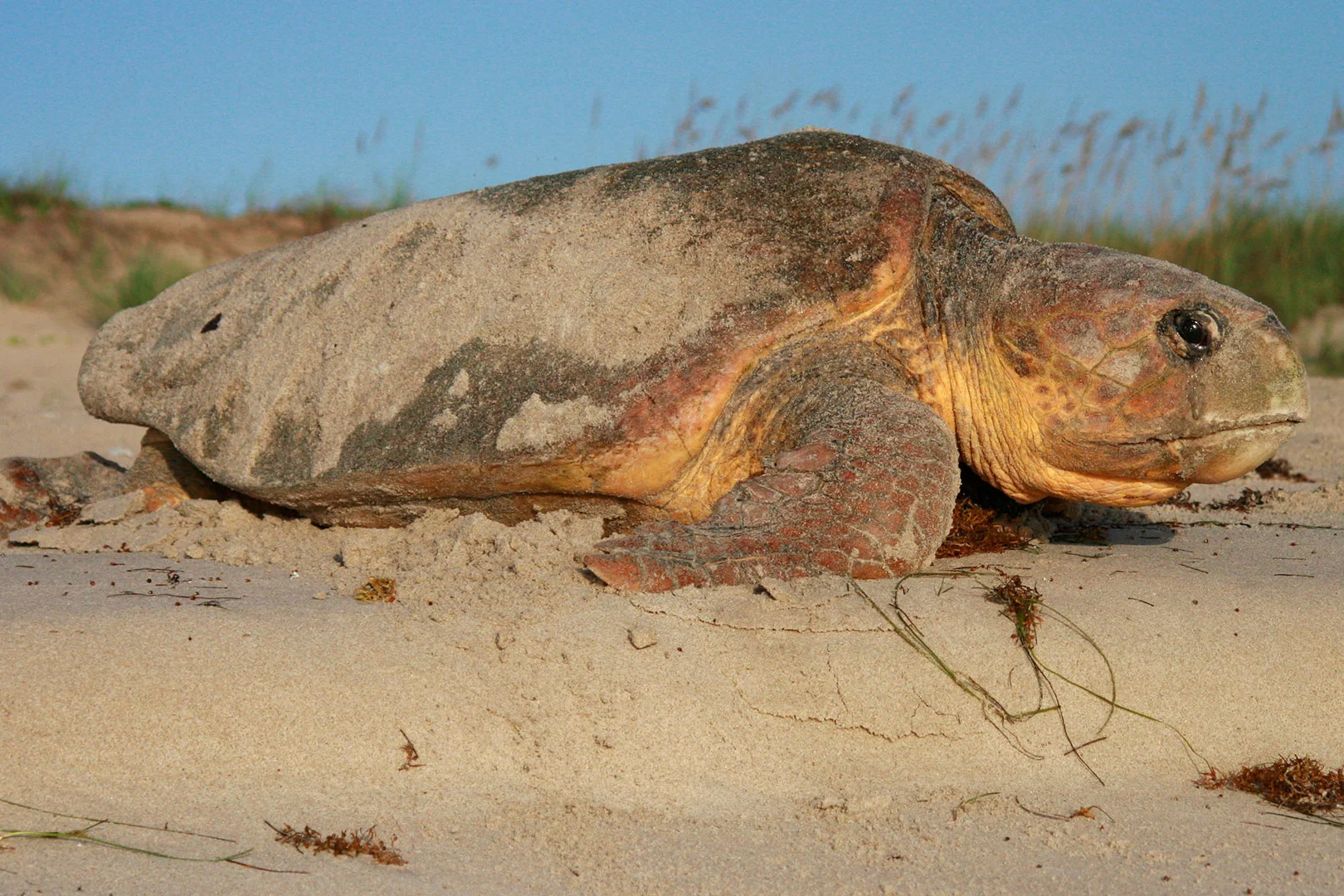
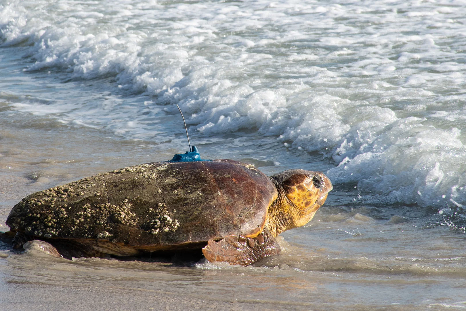
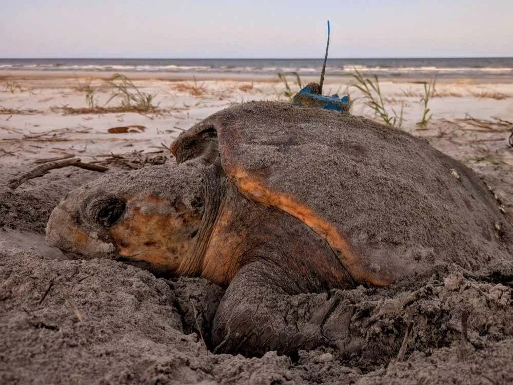
Kegan-Magnolia is an adult female loggerhead sea turtle encountered nesing on Wassaw Island, GA by researchers from University of Florida Archie Carr Center for Sea Turtle Research and the Caretta Research Project (CRP). She measured 103.2 cm curved carapace (shell) length. Kegan Magnolia was first tagged by CRP in 2017 on Wassaw NWR. She visited again to nest in 2019, 2021, and 2025. Previously, in 2011 and 2014, she nested on Hilton Head Island, Daufuskie Island, St. Catherine’s Island, and Little Tybee. She lays an average of 7 nests each year, with a total of 22 nests on Wassaw NWR, and 10 on other islands, for a grand total of 3753 eggs, and 2258 hatchlings that have emerged. At least 6 documented nests have been lost to storms or tidal surge. Through the genetics project run by Dr. Brain Shamblin at UGA, we have determined that Kegan does not have any known relatives in the North Atlantic Recovery Unit at this time. Kegan-Magnolia was released with a satellite transmitter on May 27, 2025. Data © UF Archie Carr Center for Sea Turtle Research.

Trans Alps Adventure

Migration Map

Hover over location circle to view date, and over the turtle icon to view most recent date.

Cumulative distance traveled: 2,433 km (1,512 miles)
Distance covered since last location: 4.01 km (2.49 miles)
Average speed since release: 0.67 kph (0.42 mph)
Average speed since last location: 0.16 kph (0.10 mph)
Time since last location update: 24 hours
Time tracked: 152 days

Sponsors & Partners:

On average, transmitters will send signals for around 1 year from the time the turtle is released. Sometimes it can be 2 years, and sometimes it can be less than a year. The turtle icon location point represents the most recent location received for this turtle. It is not uncommon for a transmitter to skip a day or two due to the turtle’s behavior or biofouling on the transmitter or antenna. This map is automatically updated with new points as soon as they are received by the Sea Turtle Conservancy. If the most recent point is more than two months old, then the transmitter is most likely no longer working.

The presentation of data here is for educational and entertainment purposes and does not constitute publication, and the researchers who contributed this data retain all intellectual property rights. Map, materials, images or data may NOT be used without permission. Use of this map, material, images, or data for any purpose (including, but not limited to, reproduction and distribution) without the written consent of the Sea Turtle Conservancy or the researcher/institute contributing the data is prohibited.

Map created by Mapotic for Sea Turtle Conservancy. Data and Map © STC (unless otherwise noted)

**SCAM ALERT!** If you have been offered a STC tracked turtle by purchasing something from Bela Wonder, MyTurtleProject, Mahola, Tidalia, Earth Lives, Ocean Lives, Ocean Project.co (not to be confused with ‘The Ocean Project’), Blue Ocean, Turtle’s Journey, Wildlife Team, Wildlife Mission, Wildlife Charm, or Ocean Better, they have used Sea Turtle Conservancy’s turtle tracking information without our permission. The one exception is ‘Fahlo (previously called Wildlife Collections),’ which has an exclusive partnership with STC involving our tracked turtles.